Feasibility
Feasibility insights enabling the Kick-Start
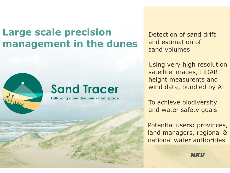
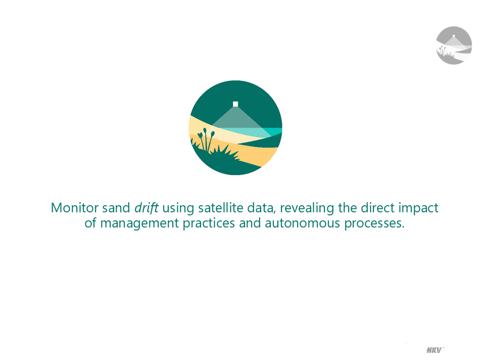
Welcome to the Feasibility Study Results page for the Sand Tracer project. These findings confirm both the critical need and technical feasibility for enhanced sand dynamics monitoring in dune ecosystems. Using AI, satellite imagery, and LiDAR, Sand Tracer is positioned to support biodiversity conservation and coastal management. The next milestone will be kick-starting prototype development.
The Sand Tracer project is an innovative effort to monitor dune sand dynamics through advanced satellite data and AI. Led by HKV, the study demonstrated that a streamlined, AI-powered system can meet key monitoring needs for dune conservation and water management.
Key objectives and findings
Project Origin and Funding: Supported by a Dutch SBIR grant from the Netherlands Space Office, Sand Tracer was developed to address pressing challenges in dune management.
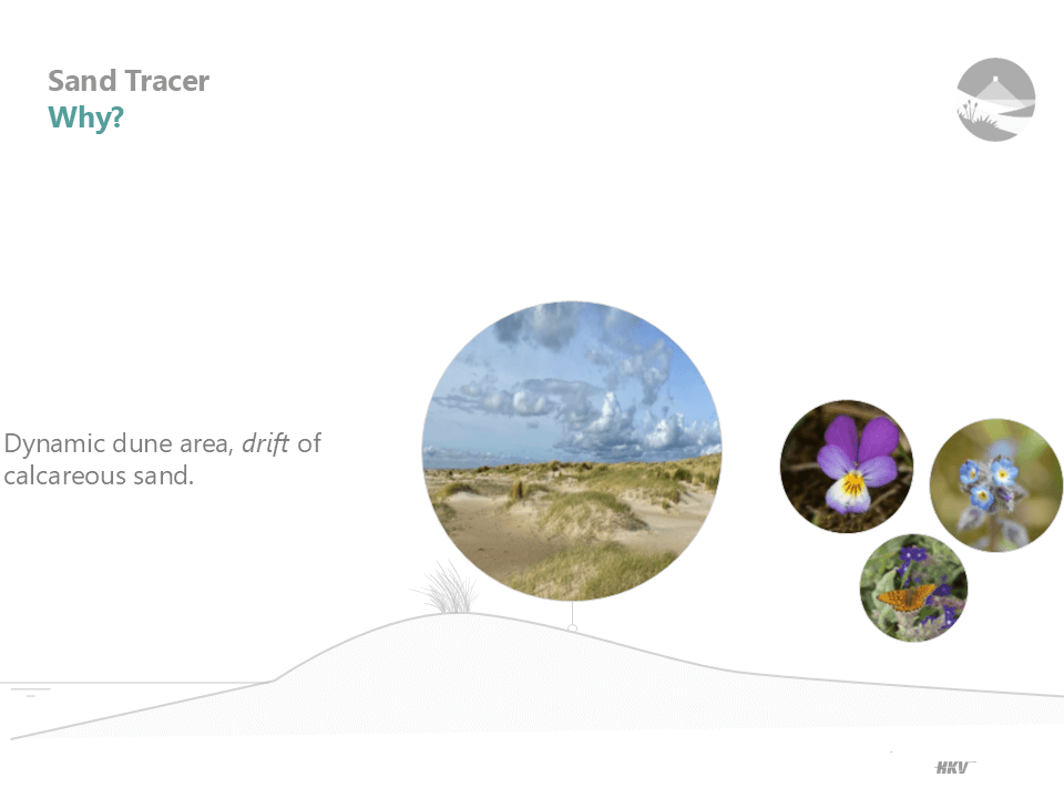
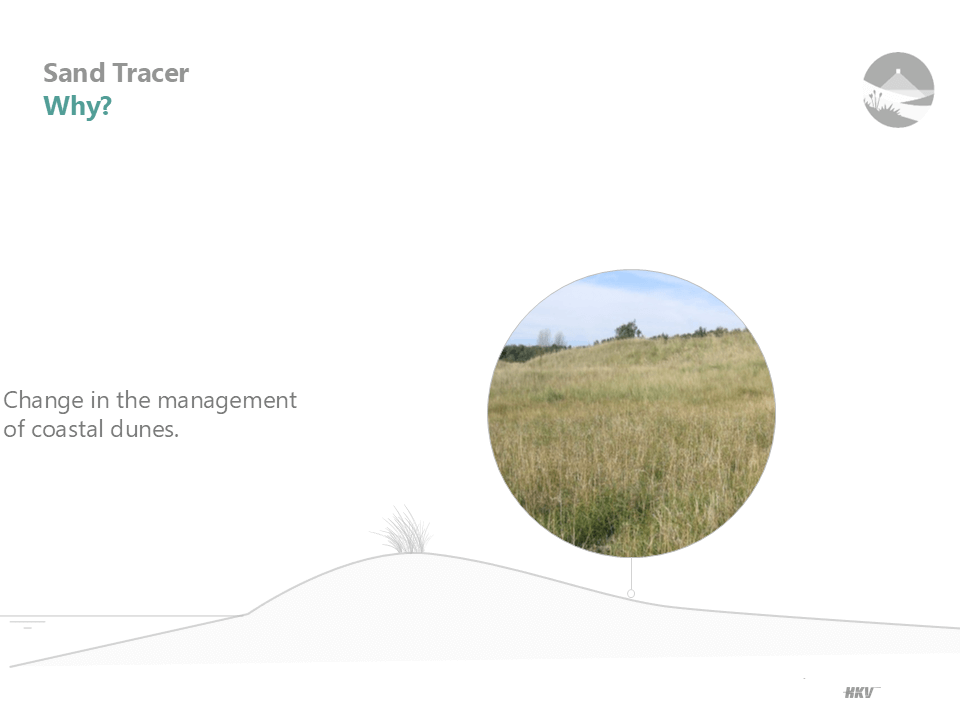
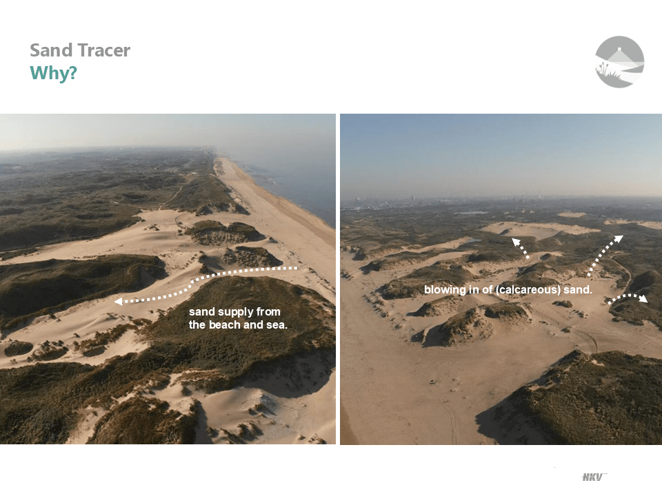
Need for Improved Monitoring: Traditional methods lack the spatial and temporal depth needed to monitor sand drift effectively. This project offers a solution to accurately track sand movement, quantify volume changes, and assess management impact on dune ecosystems.
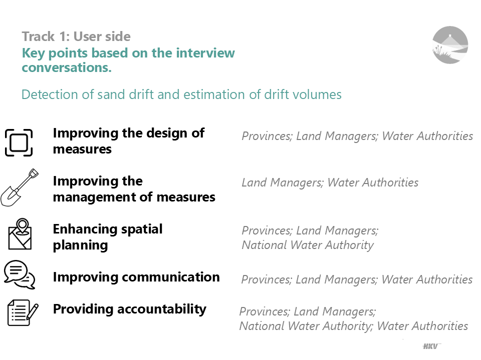
Track 1: Potential users and benefits
- Primary Audience: Sand Tracer is designed for water boards, nature conservation agencies, and governmental organizations like Rijkswaterstaat, responsible for dune management.
- Benefits: The project promises a cost-effective, efficient solution for tracking sand drift and informing dune management. Its AI-driven approach provides more accurate, timely insights than traditional methods, supporting biodiversity conservation and coastal resilience.
- Enhanced Communication: Sand Tracer facilitates improved dialogue with stakeholders about dune management impacts and conservation needs.
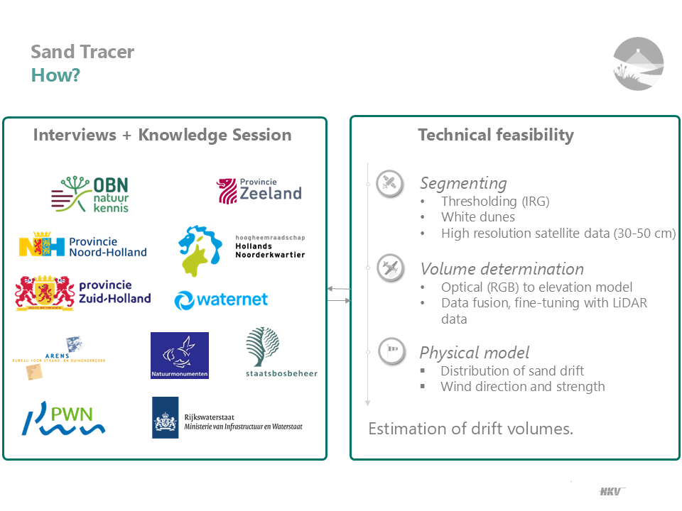
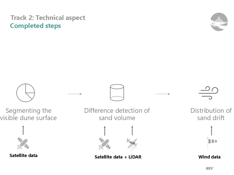
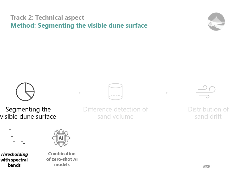
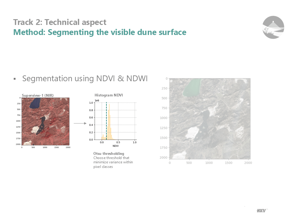
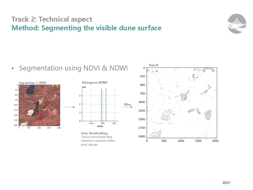
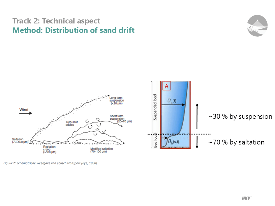
Track 2: Technology and methodology
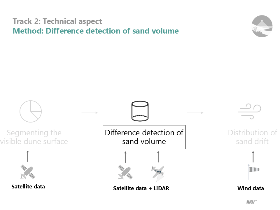
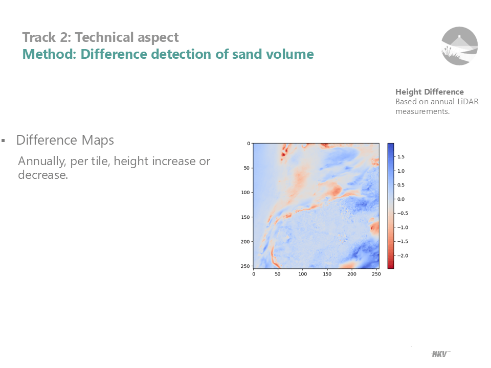
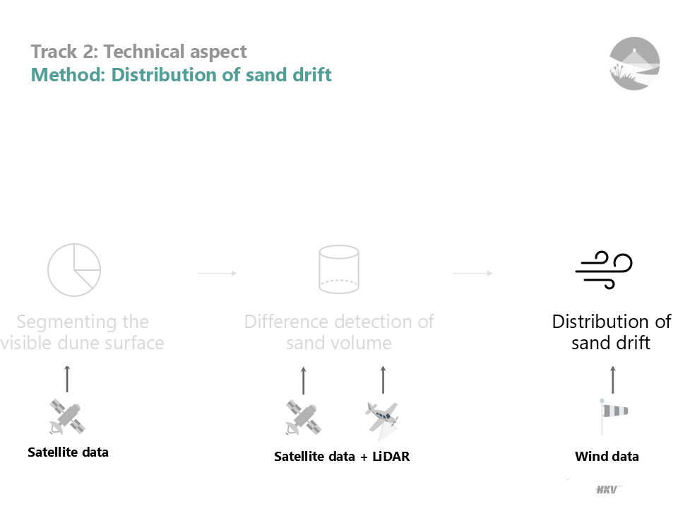
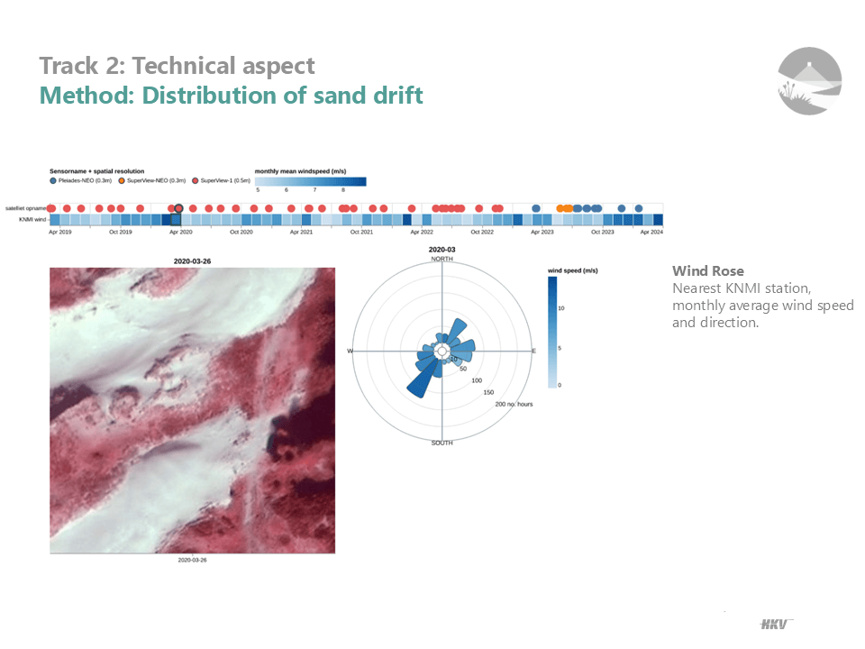
- Data Fusion: High-resolution satellite imagery combined with LiDAR data provides both frequent and precise monitoring of sand dynamics.
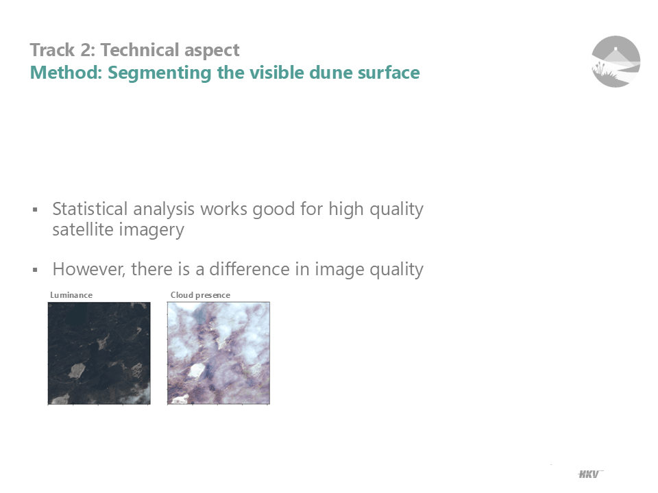
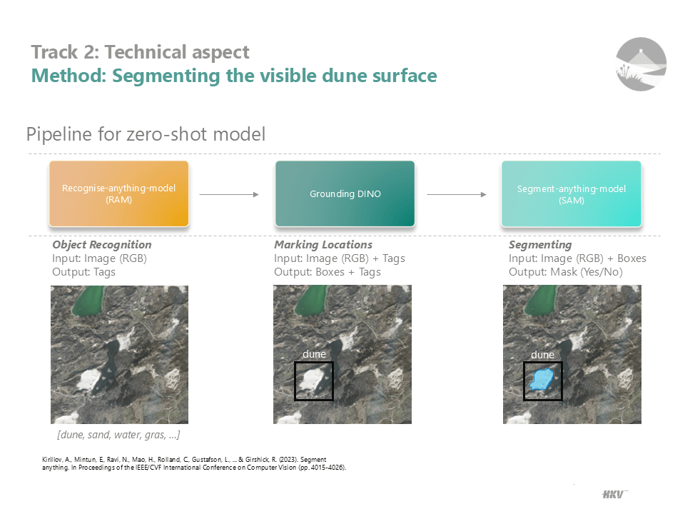
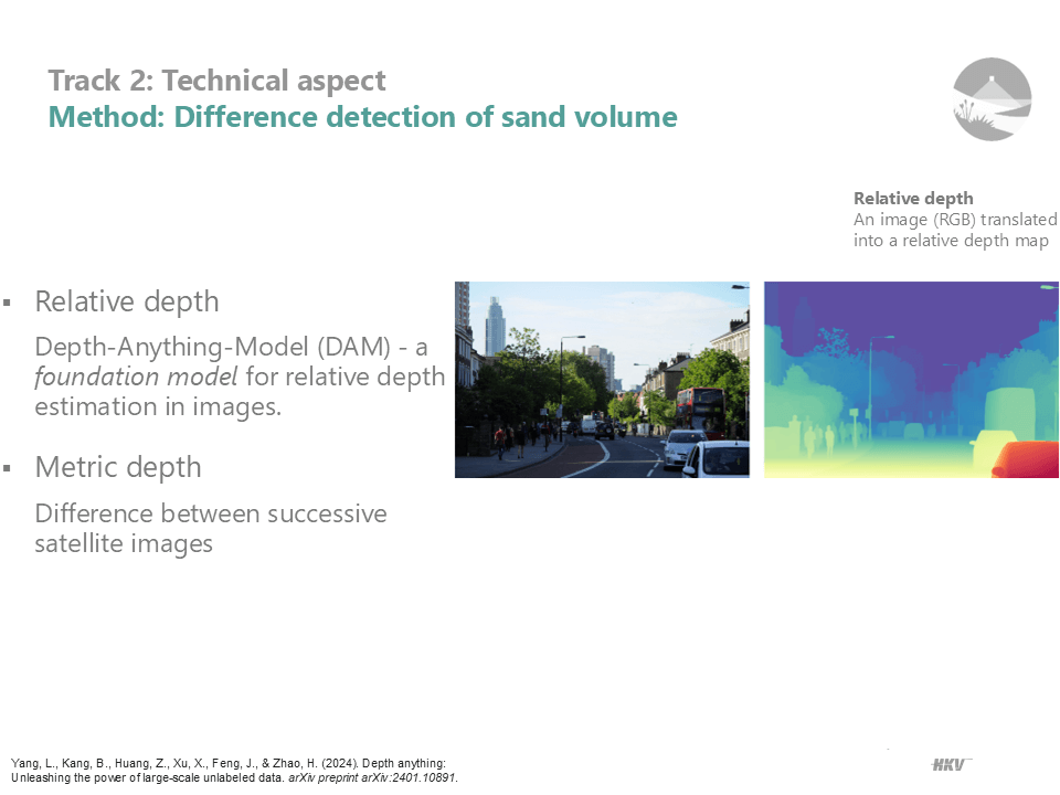
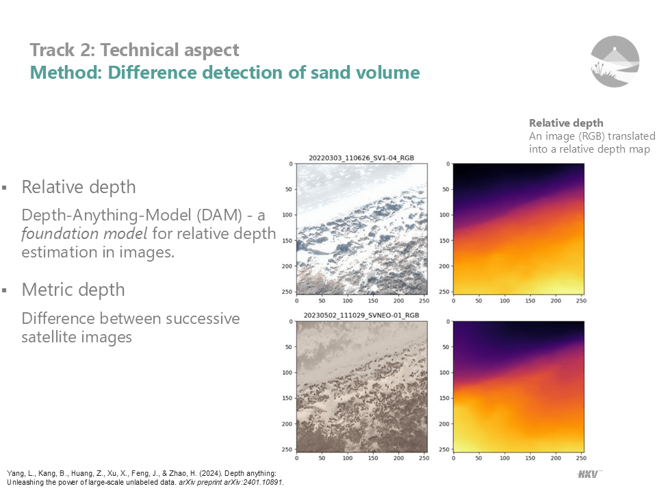
- AI Models and Algorithms: Advanced AI, including Grounding DINO and Segment Anything Model, helps segment white dune areas, while Depth Anything Model (DAM) estimates depth from optical imagery. Wind data is also integrated to track wind-related sand drifts accurately.
Challenges and key insights
- Technical Refinement: Enhancing the accuracy of AI models for dune segmentation and depth estimation is essential for actionable results.
- From Data to Insights: Effectively translating volume measurements into insights that support dune conservation and biodiversity is critical.
- User Readiness: Ensuring ease of use and alignment with existing workflows will drive adoption among diverse user groups.
Stakeholder engagement and collaboration
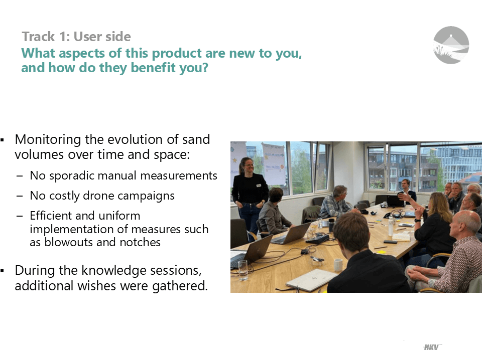
The feasibility study underscored the importance of a user-centric development process. Continuous engagement with potential users, such as water boards and nature agencies, ensures the tool meets practical needs in dune management. Collaborations with organizations like Kennisnetwerk OBN enhance project alignment with conservation goals.
The feasibility study validates Sand Tracer’s potential to transform dune management practices by leveraging advanced technology and meeting core user needs. With a solid foundation, the project’s next milestone is to kick-start prototype development, bringing Sand Tracer closer to implementation.